37% of Taxpayer-Funded Park Testing Would Not Go to Soil Testing
- Dioxin, Riverside Park
- September 3, 2019
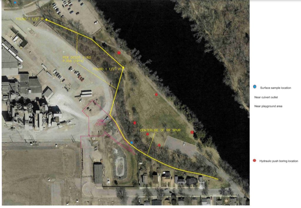
A proposal which the City may present as a compromise plan now includes only 3 samples (50% of limited samples taken) which may be relevant to the primary concern expressed by the community and council members — the runoff zone near the park’s southern forest.
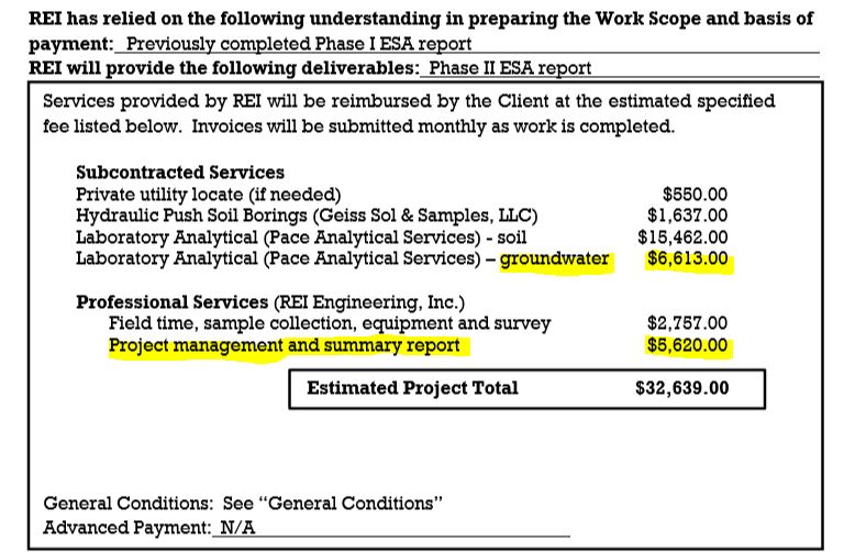
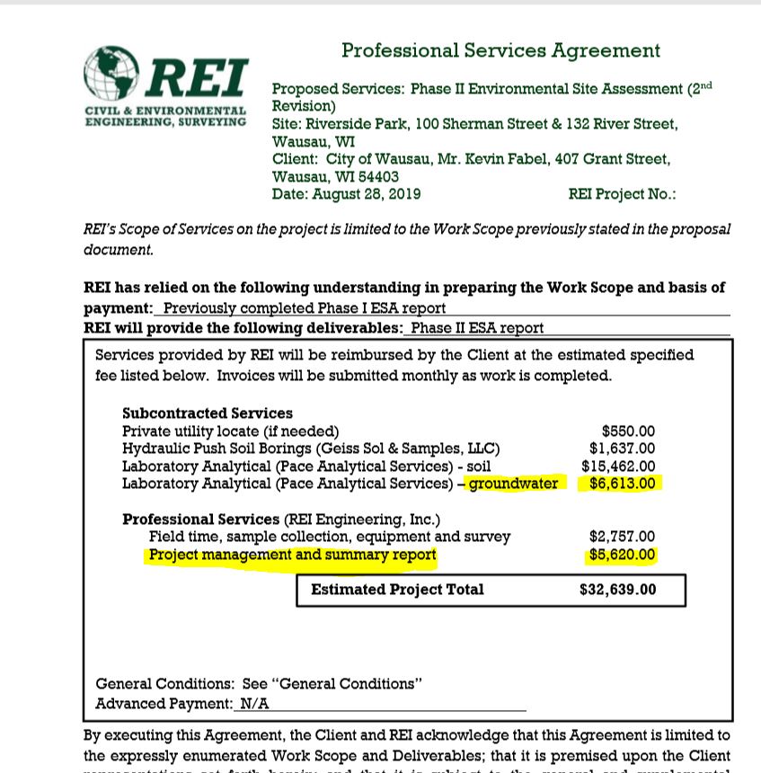
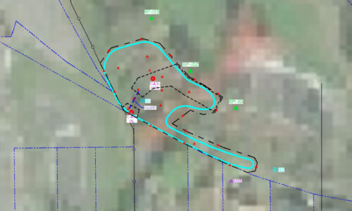
A map of revised boring locations for today’s meeting now show that 50% of them are outside of the suspected runoff zone which prompted the main concerns from community and council members to begin with. 20% of the revised plan’s costs would go to groundwater, not soil testing. 17% of the total $32K cost the City would spend would go to project management and a report written by its consultant REI.
While the staff memo included in the packet for tomorrow’s Parks & Recreation Committee recommends no testing of the park at this time, a revised REI proposal is also included. If the committee dismisses the staff recommendation of no current testing, this may be presented as a compromise plan. Unfortunately, the proposal greatly reduces REI’s initial boring number down from 20 to only 6, and 50% of the borings are now nowhere near the runoff zone which is below the culvert area and near the edge of the forest. 37% of this plan’s total taxpayer funded costs would go to non-soil-testing related fees, including groundwater testing and the consultant’s management and report.
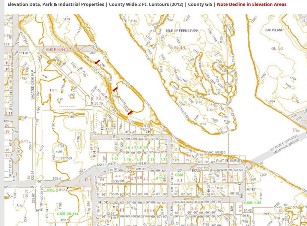
The map of proposed boring locations can be found on page 23 of the committee packet. Note that only three are near the forest edge in the suspected runoff zone, and it is still unclear if they are located in the correct elevation areas, as demonstrated by both Marathon County and DNR data.
The goal of citizens and several council members has been to fully define the extent of dioxin contamination in the park stemming from the culvert area and other runoff zones near the edge of the eastern forest in the park. Now half the proposed samples are nowhere near the identified zone. 20% of the total cost for what a requested soil study now goes to groundwater sampling. According to recent Pace Analytical lab pricing, 9 additional soil dioxin samples could be analyzed from the park instead of testing groundwater — some of which is routinely monitored by WAULECO in its DNR-monitored remediation program).
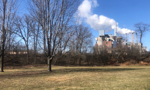
CCW’s presentation about Riverside Park at City Hall on July 23, laid out in great detail elevations, runoff patterns, and contaminants of concern. The information had been gleaned from Marathon County and DNR data sources. Images of elevation and runoff pathways can be found below.
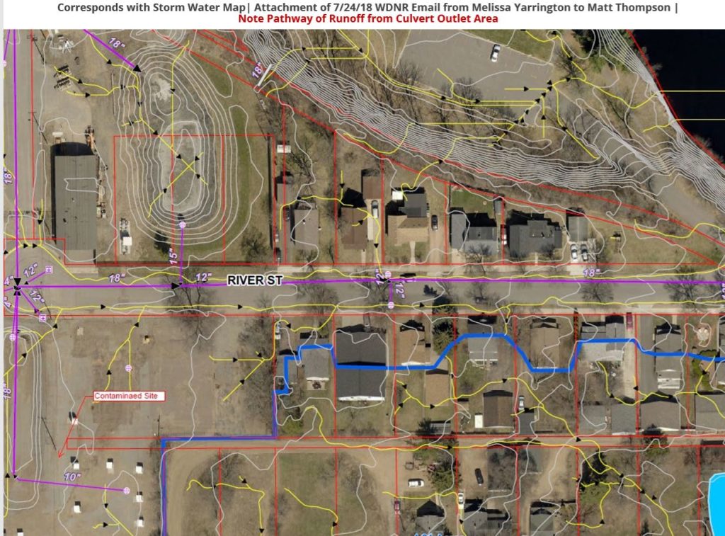
Additionally, last year CCW documented through video the runoff which appeared to be stemming from the industrial properties to the west of the park, and ponding at the bottom of the park’s forest. However, REI’s proposal in the packet for tomorrow appears to dismiss most of CCW’s data and documentation, while suggesting that 50% of the borings should now reside at the other (eastern) side of the park outside of this zone.
